LiDAR Vehicle Volume Measurement Robot
1. Product Overview
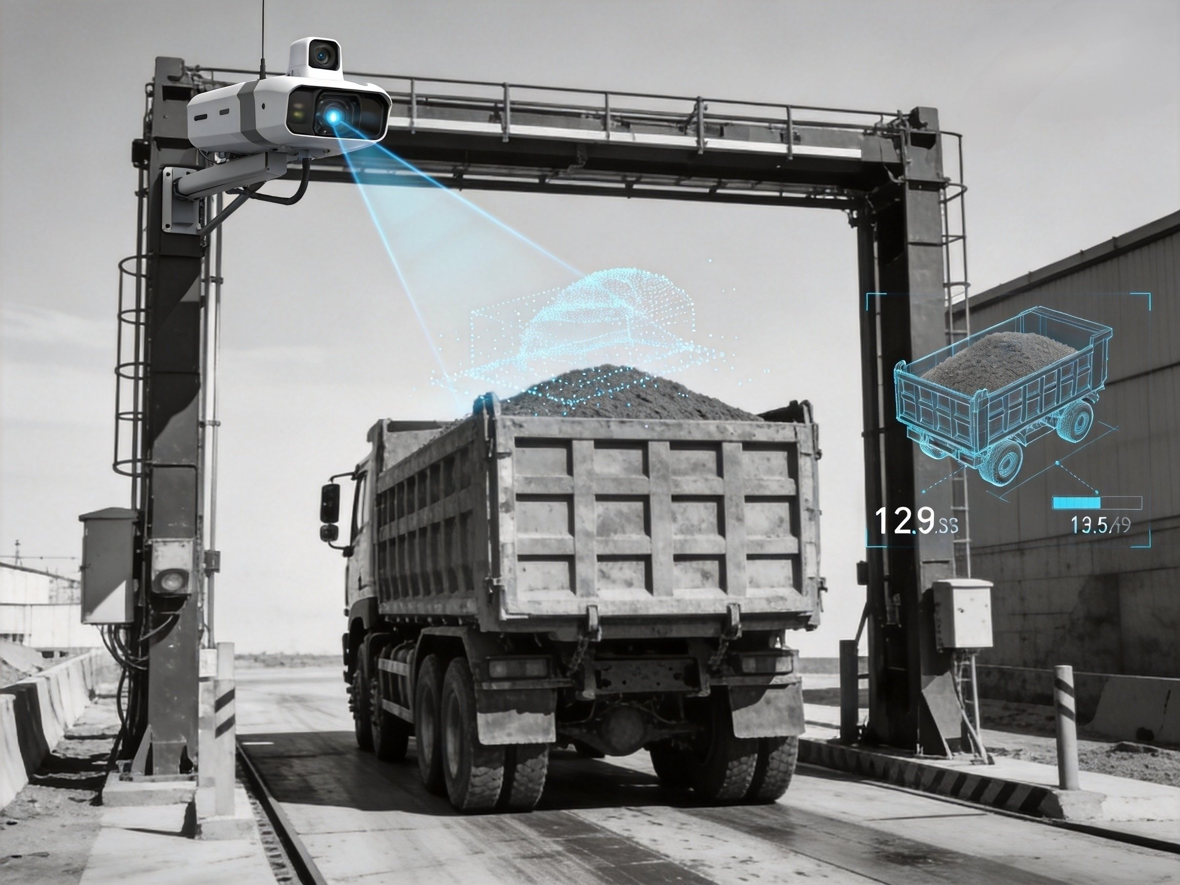
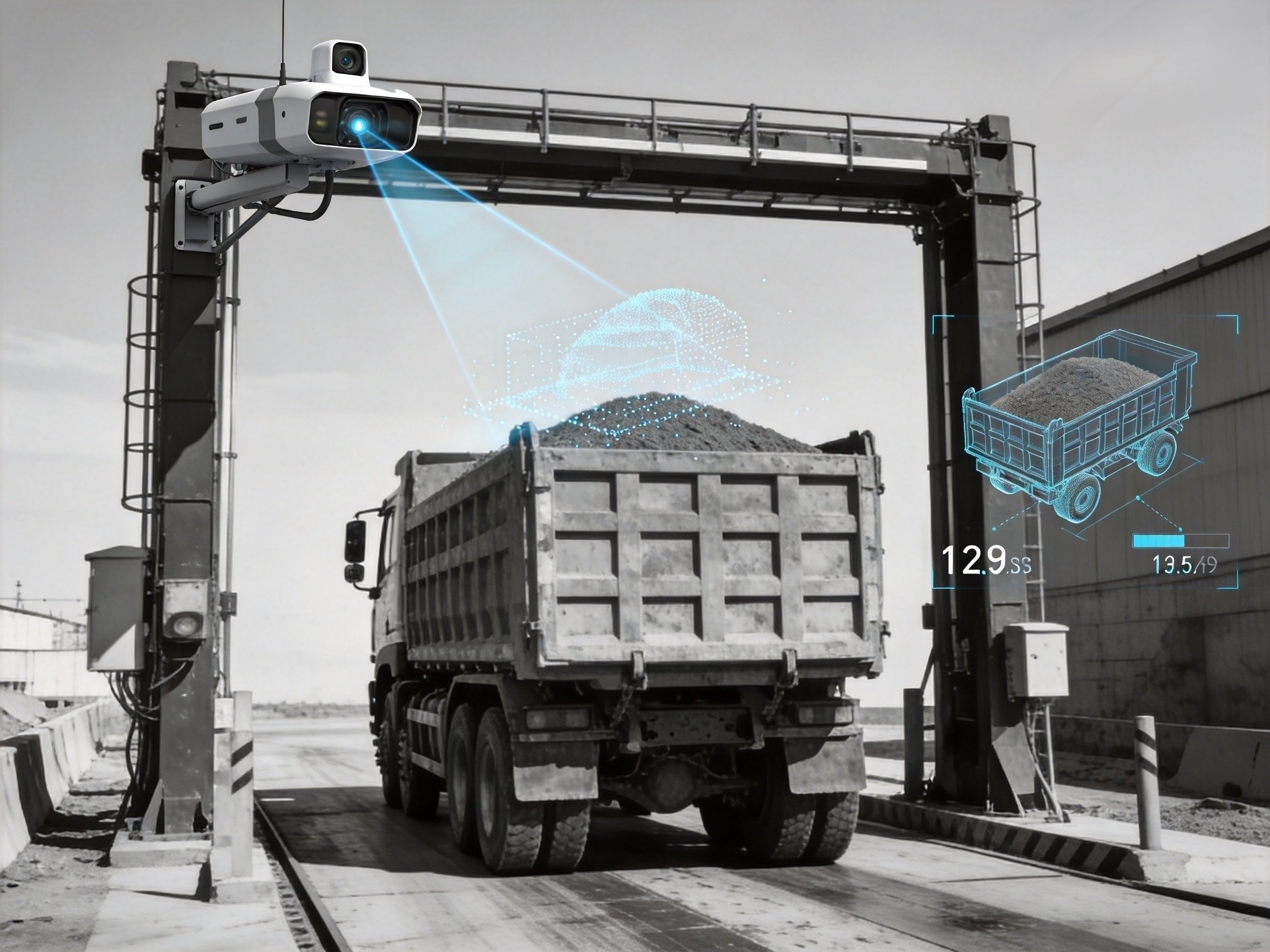
The LiDAR Vehicle Volume Measurement Robot is an intelligent measuring device exclusively developed by our company with core patented technologies, designed for industrial and mining scenarios. Equipped with our self-developed industrial embedded Linux system, it is tailor-made for complex outdoor working conditions such as mines, earthwork projects and sand and gravel transportation. Breaking the drawbacks of traditional manual measurement and estimation statistics, the device adopts high-precision LiDAR scanning, AI intelligent algorithm correction and 3D point cloud modeling technologies to realize fully automatic and accurate measurement of material volumes of empty and loaded vehicles, and supports switching between dynamic and static measurement modes.
The whole machine adopts industrial waterproof and dustproof design, suitable for all open-air outdoor working environments, capable of withstanding extreme high and low temperatures, and supporting 24/7 uninterrupted continuous vehicle measurement all year round. Integrating multiple functions including image capture, video recording, license plate recognition, RFID card reading, cloud data transmission and remote operation and maintenance, and matched with dual management backends for PC and mobile terminals, it thoroughly addresses industry pain points such as large statistical errors of transported materials in industrial and mining sectors, high labor costs, difficult data traceability and non-standard management. It serves as core equipment to support digitalized and unmanned management of engineering transportation.
2. Core Hardware Parameters
The core LiDAR of this device is a self-developed patented product with complete compliance certificates, featuring stable performance, safety and reliability, and compatibility with various harsh industrial and mining scenarios. All hardware of the whole machine adopts industrial-grade configuration to ensure long-term stable operation.
Basic Parameters of the Whole Machine
System Architecture: Fully self-developed industrial embedded Linux system, free of lagging and data loss
Power Supply Specification: DC 12V (10A), wide voltage range of 9~20VDC for safe and stable operation
Overall Power Consumption: 80W, low-power operation for energy conservation and environmental protection
Working Environment: Specially designed for open-air outdoor use, operating temperature from -30℃ to 60℃; customized adaptation available for extreme weather
Vehicle Passing Capacity: Supports continuous vehicle passage, 24/7 non-stop operation with no restriction on operation intervals
Measurement Accuracy: Multiple optional accuracy levels (<1%, <2%, <3%, <4%, <5%) to meet metering standards for different scenarios
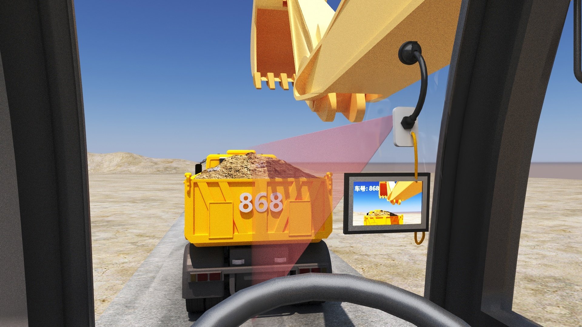
Display Configuration: Outdoor high-brightness LED display screen with clearly visible numbers under direct sunlight, enabling drivers to check vehicle passing data intuitively
Capture Device: Customized camera with 1600×1200 high definition, all-weather color capture with clear noise-free images at night
Operation Screen: Industrial 7-inch capacitive touch screen with sensitive and smooth touch operation
Interface Design: Full-range aviation plug interfaces, plug-and-play without wiring for convenient and stable installation
Warranty Service: Three-year warranty for core equipment with comprehensive after-sales support
Core Parameters of Patented LiDAR
Model: JYJQ300 (self-developed patented model)
Laser Wavelength: 905nm, complying with industrial safety standards
Safety Class: Class 1 eye-safe level (IEC60825-1:2014) with zero safety risks during operation
Scanning Range: 40m at 10% reflectivity, 60m at 80% reflectivity, compatible with all sizes of transport vehicles
Scanning Performance: Maximum scanning distance of 80 meters, 500,000 point cloud data per second to accurately restore vehicle shapes
Field of View: 360° horizontal full-view scanning, vertical wide coverage from -7° to 52° with no scanning blind zones
Measurement Error: 2m ranging random error at 20 meters; angular random error <0.15%, leading industry precision
Point Cloud Output: High-speed output of 300,000 points per second for real-time 3D model construction
Transmission Mode: 100 BASE-TX Ethernet high-speed data transmission
Ingress Protection Class: IP67 waterproof and dustproof, suitable for harsh working conditions including open-air sites, dust, rain and snow
False Alarm Rate: <0.01%, powerful anti-interference capability to eliminate invalid data
LiDAR Power Consumption: 12W, low power consumption with wide adaptability
3. Core Working Principle
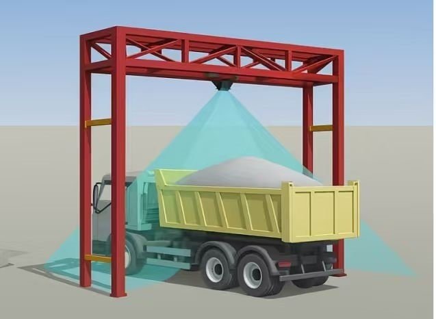
The complete measurement system consists of a control main cabinet, high-precision laser scanner, vehicle license recognition system, high-definition image capture system, outdoor LED display system, intelligent measurement software, 4G/5G wireless transmission system and cloud management terminals (PC + mobile terminals). Adopting a distributed multi-radar scanning architecture, the device collects 360° omnidirectional point cloud data of transport vehicles. It supports bidirectional scanning measurement for empty and loaded vehicles, and allows presetting basic volume parameters of empty vehicles to adapt to diverse operation scenarios.
Self-developed core algorithms intelligently synthesize and precisely calculate two sets of scanned data, automatically filter environmental interference data, and accurately compute the actual volume of materials loaded on vehicles. The system supports offline independent operation. Measurement and data storage can function normally without network access, and data will be automatically synchronized and uploaded once network connectivity is restored. This ensures 100% complete data transmission without loss or packet dropout, enabling stable all-year-round operation. Meanwhile, the device can output 3D vehicle point cloud models and color real-scene models in real time to visually display vehicle loading status with superior data visualization.
4. Advantages of Core Algorithm Software
Leveraging the company’s original core algorithm technology, the device overcomes the industry challenge of dynamic measurement accuracy. Its algorithm performance far exceeds traditional measuring equipment with prominent core advantages:
Automatic Dynamic Distortion Correction: Intelligently corrects scanning data distortion caused by vehicle movement and bumping, completely eliminating measurement errors during dynamic vehicle passing.
Intelligent Vehicle Body Sinkage Calculation: Exclusive algorithms accurately identify sinkage height of empty and loaded vehicles, matching actual loading conditions and greatly improving measurement accuracy.
Multi-radar Blind Zone Compensation: Intelligent multi-radar pose conversion technology fully compensates blind zones of single radar scanning and realizes full-vehicle data collection without dead angles.
3D Real-scene Restoration: Real-time construction and output of colored 3D vehicle models to truly restore vehicle appearance and loading status for convenient visual traceability.
Dual-mode Measurement Adaptation: Free switching between dynamic and static measurement algorithms, allowing flexible selection of measurement modes according to on-site traffic flow and operation requirements.
5. Core Functional Highlights of the Whole Machine
Industrial-grade Stable Operation: Self-developed embedded Linux system prevents crashes and lagging, permanently stores data, and supports non-stop all-year-round monitoring.
All-weather High-definition Recording: Customized full-color capture camera delivers high-definition color imaging day and night, with 24-hour continuous video recording. Optional short video storage for vehicle passing is available, enabling traceable data for every vehicle.
Intelligent Dual Recognition Adaptation: Supports dual modes of high-power high-speed RFID card reader and intelligent license plate recognizer, applicable to ETC vehicle passage and ordinary vehicle access scenarios.
Visual Data Display: Outdoor high-brightness LED screen displays measurement data of each vehicle in real time. Drivers can check loading volume and passing information for efficient and transparent vehicle clearance.
Simplified Installation and Operation & Maintenance: Aviation plug wiring-free design enables plug-and-play for easy installation. Parameters can be directly adjusted locally via the industrial touch screen.
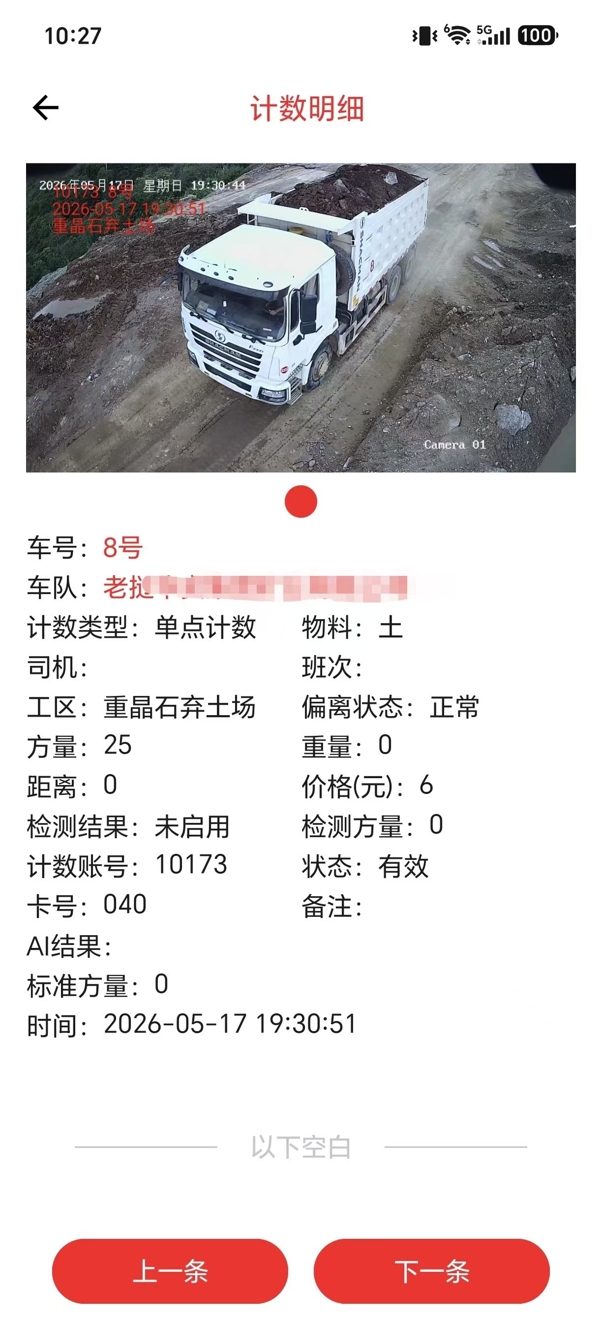
Cloud Remote Management: Dual backends for mobile and PC terminals support real-time remote viewing of vehicle passing data, statistical report generation and equipment parameter adjustment. Remote operation and maintenance eliminate the need for on-site work.
Patented Technology Support: Core LiDAR and measurement algorithms are self-developed patented technologies. The product has authoritative performance certification with reliable quality and strong competitiveness.
Excellent Environmental Adaptability: Resists harsh working conditions including high temperature, extreme cold, dust, rain, snow and strong sunlight. Suitable for all open-air scenarios such as mines, earthwork sites and sand and gravel plants.